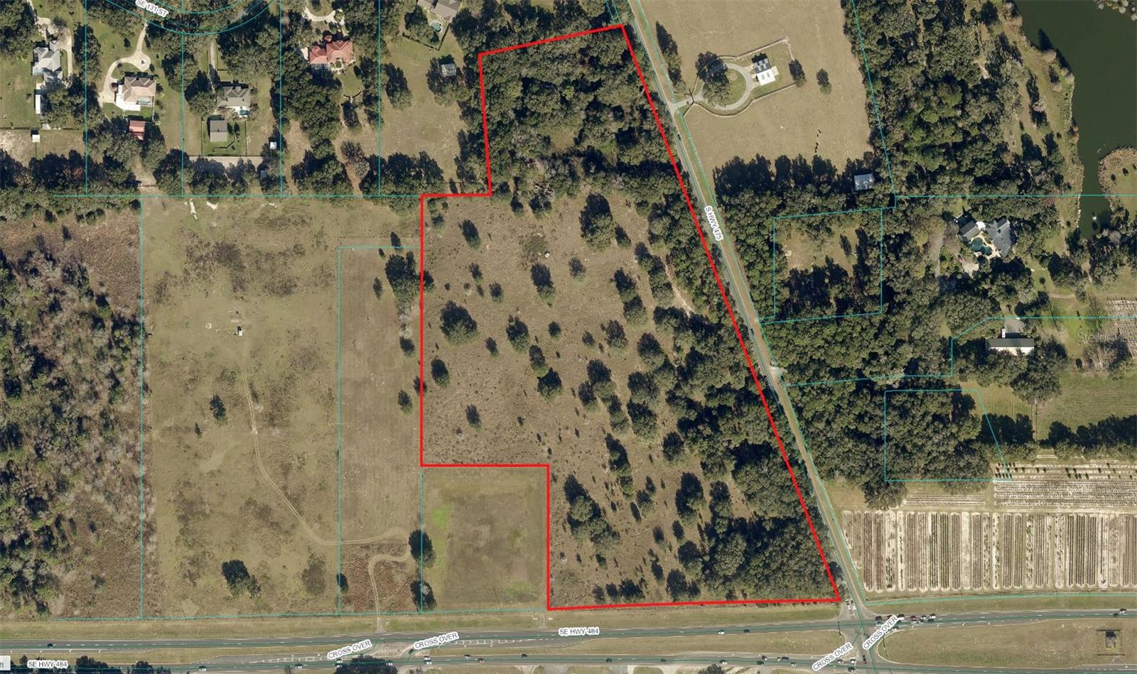
Corner Hwy 484 & Hwy 475, OCALA, FL 34480
Property Photos
Would you like to sell your home before you purchase this one?
Priced at Only: $2,500,000
For more Information Call:
Address: Corner Hwy 484 & Hwy 475, OCALA, FL 34480
Property Location and Similar Properties
- MLS#: G5090346 ( Land )
- Street Address: Corner Hwy 484 & Hwy 475
- Viewed: 75
- Price: $2,500,000
- Price sqft: $0
- Waterfront: No
- Year Built: Not Available
- Bldg sqft: 0
- Days On Market: 37
- Additional Information
- Geolocation: 29.027 / -82.1228
- County: MARION
- City: OCALA
- Zipcode: 34480
- Elementary School: Belleview
- Middle School: Belleview
- High School: Belleview
- Provided by: AKIN REALTY COMPANY
- Contact: Fran Dann-Akin
- 352-804-2446

- DMCA Notice
-
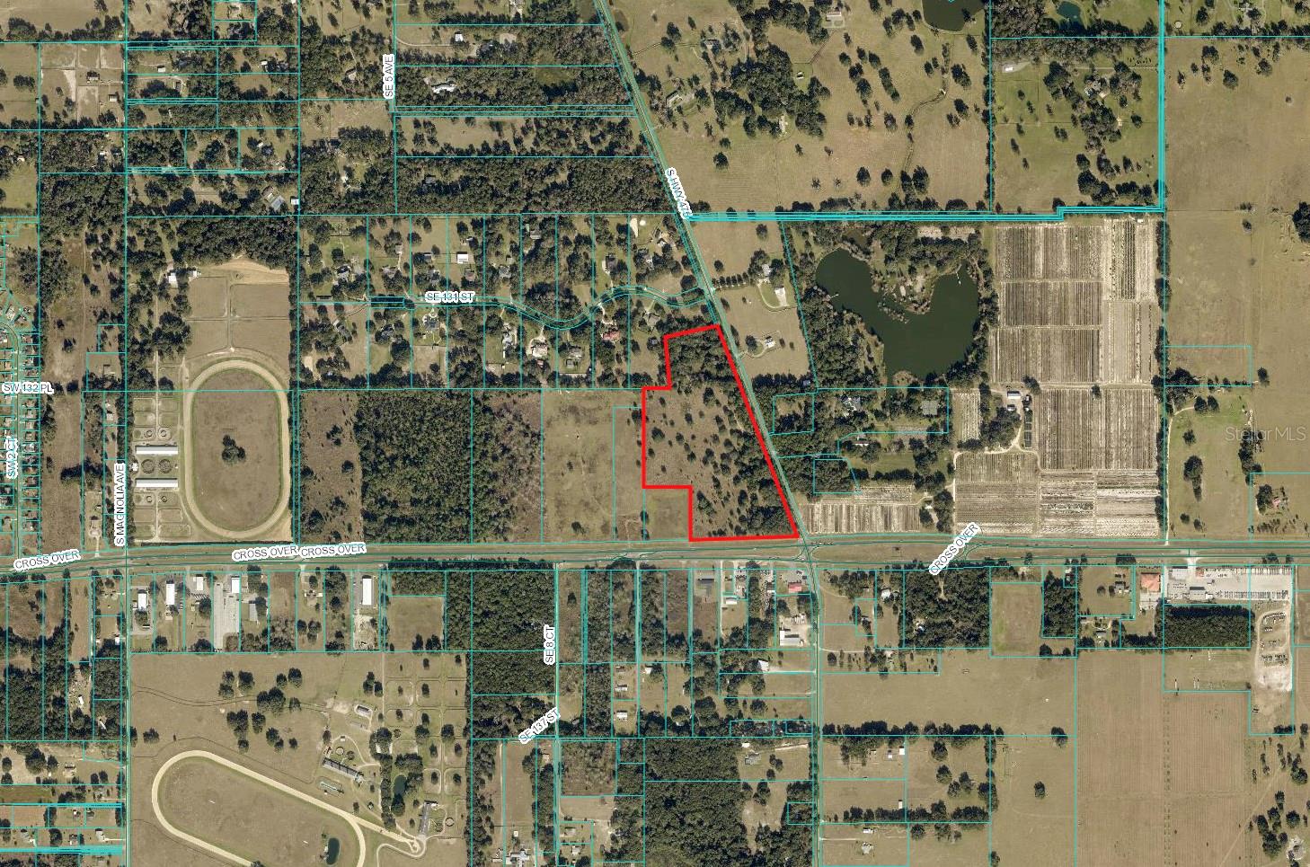
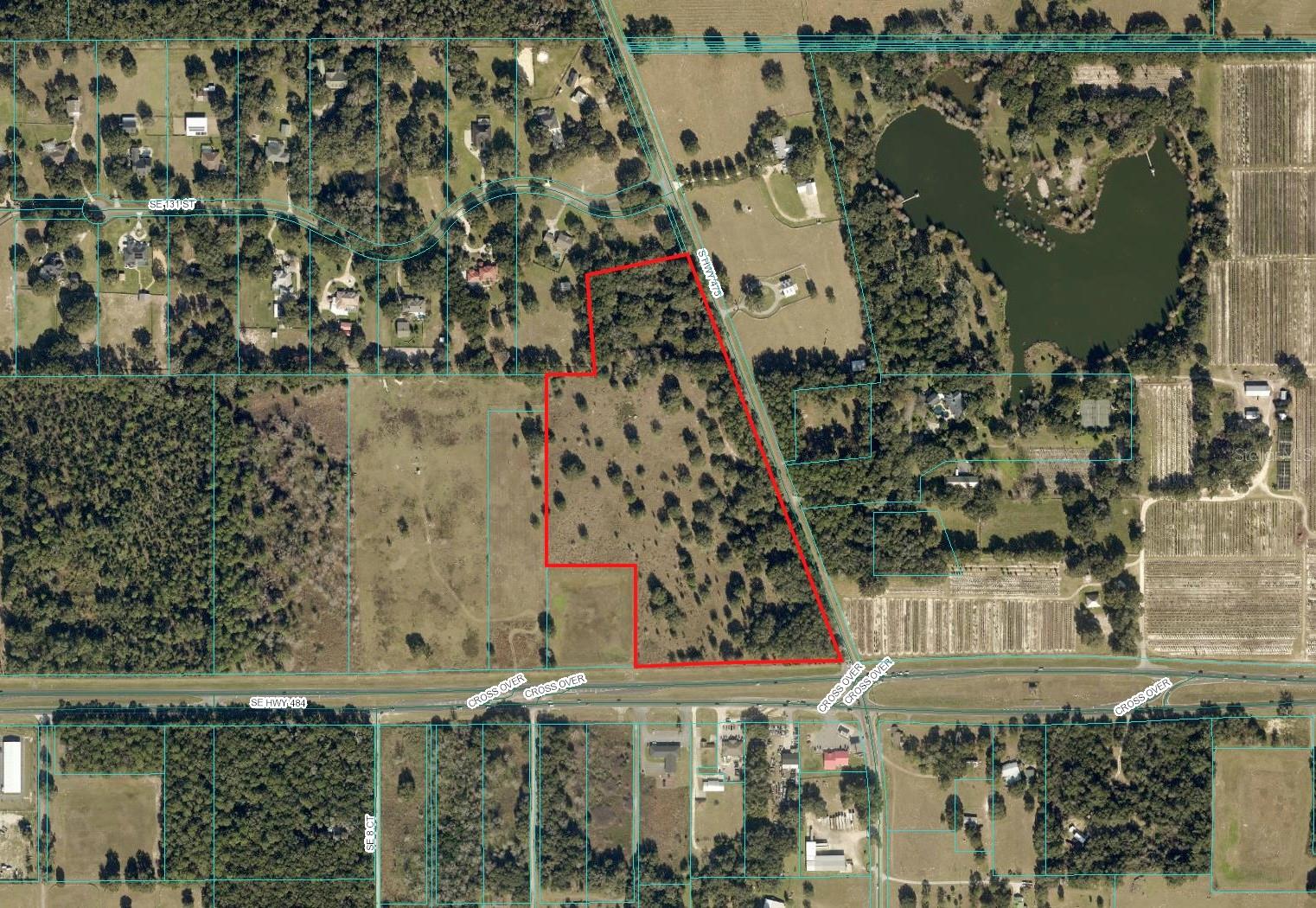
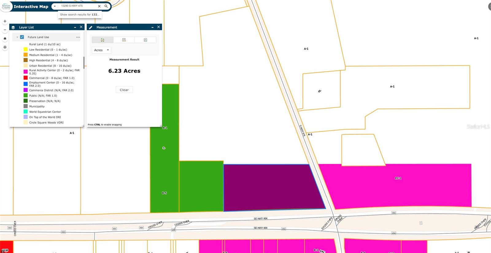
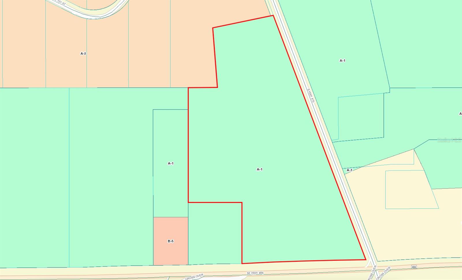
DescriptionDevelopment Potential: 26.68 acres at NW Corner Hwy 484 & Hwy 475 Signalized Intersection. Only 2 miles east of I 75. 6+ acres at hard corner designated land use for Rural Activity Center (RAC) Commercial / 26.68 acres currently A 1 zoning. 830 frontage on busy Hwy 484 in expansion with explosive growth heading west. Outstanding location for high volume retail development. Average daily traffic count: 21,800. Existing residential well on property. Florida Horse Park & Greenways located only 2 miles North on Hwy 475
Payment Calculator
- Principal & Interest -
- Property Tax $
- Home Insurance $
- HOA Fees $
- Monthly -
Features
Building and Construction
- Covered Spaces: 0.00
- Living Area: 0.00
School Information
- High School: Belleview High School
- Middle School: Belleview Middle School
- School Elementary: Belleview-Santos Elem. School
Garage and Parking
- Garage Spaces: 0.00
Eco-Communities
- Water Source: Well Required
Utilities
- Carport Spaces: 0.00
- Sewer: Septic Needed
- Utilities: Electricity Available
Finance and Tax Information
- Home Owners Association Fee: 0.00
- Net Operating Income: 0.00
- Tax Year: 2024
Other Features
- Country: US
- Current Use: Commercial
- Legal Description: SEC 08 TWP 17 RGE 22 SE 1/4 OF NE 1/4 W OF SR 475 & COM AT NE COR OF SEC 8 TH W ALONG N BNDY TO THE W ROW LINE OF SR 475 TH S 20-29-00 E 910.14 FT TO THE POB TH S 78-18-10 W 405.81 FT TH S 04-25-50 E 392.49 FT TH N 89-58-10 E TO THE WLY ROW LINE TH N 20-29-00 W TO THE POB EXC THAT PT LYING WITHIN FOLLOWING DESC BOUNDARIES: COM AT NE COR OF SEC 8 TH S 00-04-17 W 2654.19 FT TH S 89-45-52 W 106.01 FT TH N 00-14-08 W 50 FT TO THE POB TH S 89-45-52 W 1213.16 FT TH N 00-03-56 E 520.36 FT TH N 90-00-00 E 353.87 FT TH S 00-00-00 W 401.86 FT TO A PT ON A CURVE CONCAVE SLY HAVING A RADIUS OF 17069.14 FT A CHORD BEARING OF N 88-16-08 E TH ELY ALONG ARC OF CURVE THRU A CENTRAL ANMGLE OF 02-44-02 814.24 FT TO END OF CURVE & POINT LYING ON EXISTING SWLY
- Area Major: 34480 - Ocala
- Parcel Number: 41482-000-00
- Views: 75
- Zoning Code: A1
Similar Properties
Nearby Subdivisions
Baseline Bus Center
Bellechase
Bellechase Cedars
Bellechase Heron Trace
Bellechase Laurels
Bellechase Woodlands
Country Clubocala Un 02
Florida Orange Grove
Florida Orange Grove Corp
Golden Ocala Un 01
Juniper Circle
Magnolia Grove
Magnolia Park
Magnolia Villas East
Marion Oaks Un 04
Marion Oaks Un 06
Orange Ave Surburban Sites
Rolling Hills Un 04
Roosevelt Village Un 01
Santos
Silver Spgs Shores
Silver Spgs Shores 24
Silver Spgs Shores Un 24
Silver Spring Shores
Silver Springs
South Hammock
Via Paradisus
Via Paradisus Ph 01
Via Paradisus Phase Iii
Vinings
Whispering Sands Un 01


